Why?
Edinburgh may be Scotland's capital, but I am of the opinion that Glasgow is Scotland's premier city. This spring and summer, I have noticed more and more Glaswegians making use of the cycle hire operator we have, and so I've seen the streets filled with the salmon pink hire bikes. I have cycled on and off throughout my life, but have always wanted to pick it back up. This summer seems to have been the right time. The cycle network is growing with routes on Byres Road, Argyle Street, and on Pitt Street, but no coherent system of routes exists in Glasgow.
Some routes are known as ways: The South City Way running from King Street to Queen's Park, for example, or the West City Way which runs from Central Station, over the M8 to Kelvingrove Park. These are, for the most part, segregated cycle routes, built to a good standard and allow for quick routes between these areas. Since they are segregated, they are also easy to follow. Other routes form part of the National Cycle Network. Routes 7, 75, 754, 756 criss-cross the West End and Southside of Glasgow, and some signage exists for these. But I believe most people would probably know them better as the cycle path next to the Clyde, the Kelvin Walkway, the Maryhill Canal, and the White Cart Walkway[1]. These routes are also, for the most part, easy to follow because they follow routes of rivers or canals.
There is one more cycle path I have noticed around the West End. It is furtive, and shown only through three or four signs. The Colleges Cycle Route runs from the University of Strathclyde, via Glasgow Caledonian University and the University of Glasgow, to the former Jordanhill College. This route was designated before any of the better cycle infrastructure was built in Glasgow, and so while at points cyclists are separate from drivers, most of the route follows busy-ish roads. This route is also impossible to follow from signs alone. Potentially, Glasgow City Council do no longer consider this a good cycle route, and so want to discourage people using it as a path, but this points to a major fault, in my opinion, of Glasgow's cycling boom. There is no good source of cycle routes to use to cycle across the city safely.
If I were to follow current cycling directions, even from cycling websites, I would have cycled many times down Newton Street and North Street, two busy roads next to the M8 which would have made me fear for my life. On the other hand, Sauchiehall Street and Buchanan Street are designated as "core routes", which are streets and paths that by law allow cycling. Buchanan Street, the pedestrian core of the City Centre, is always filled with shoppers, buskers, and preachers, among others. That is not a road I would want to cycle down and I doubt shoppers want to be subjected to a peloton of cyclists whilst trying to enter the Buchanan Galleries either.
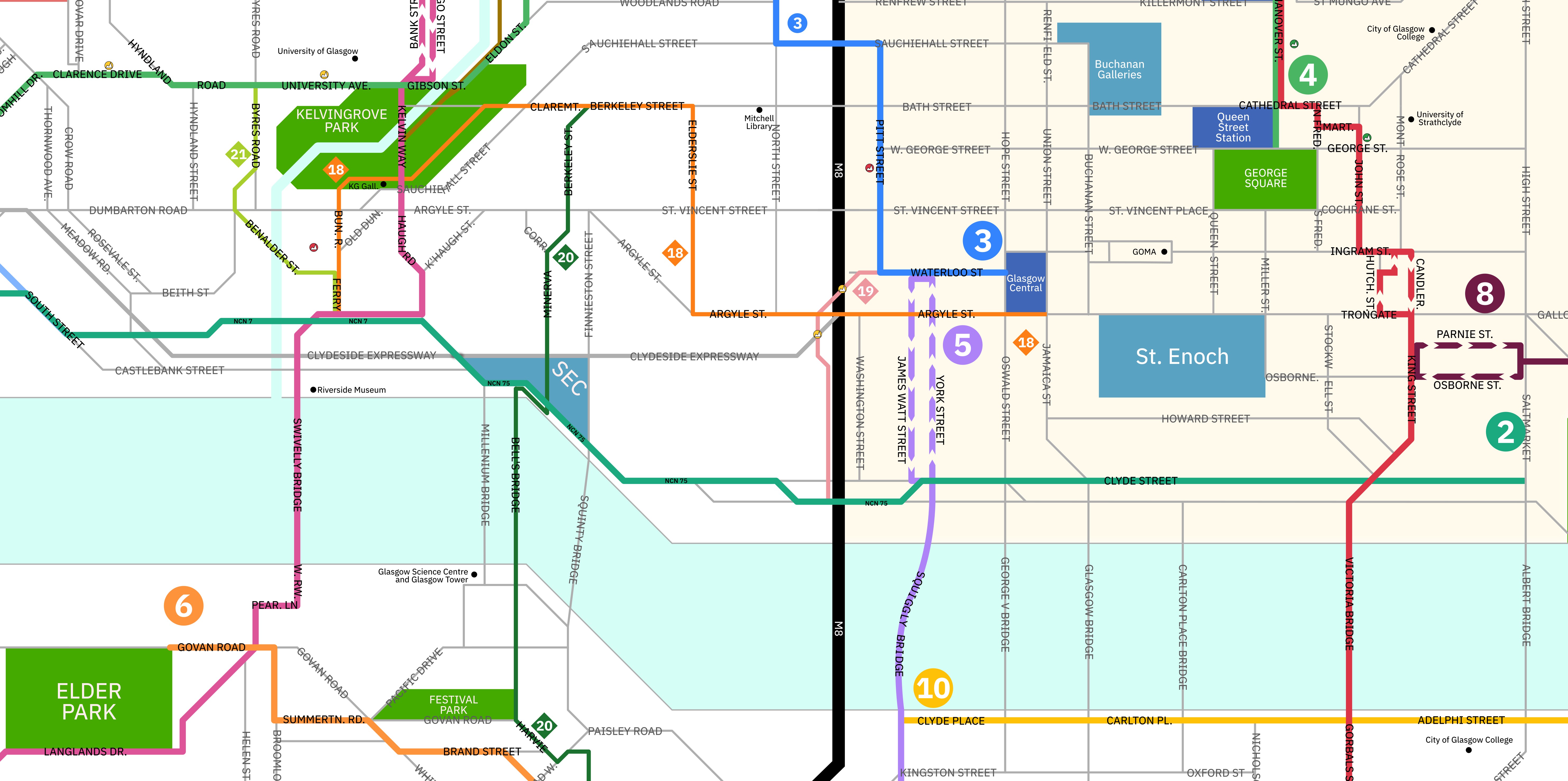
This is where this project Cycleable Glasgow comes in. I have taken it upon myself, to design and cycle as many routes as possible throughout the city, find ways that seem safe, direct, pleasant, or useful. Each of these routes are assigned a number[2] and aim to get people across and around the city convieniently and safely.
The map alone isn't enough, however. So a second part of this project, is to design for the city clearer wayfinding.
I live in the West End, and have undertaken this project solo. This means that parts of the city, like Cardonald and Dennistoun, don't yet feature because I haven't been able to get out to those parts. Fingers crossed I am able to get their layouts and an idea of routes for them soon.